Formulation Regionalization#
Introduction#
The formulation regionalization process identifies optimal NextGen formulations for calibrated (and/or uncalibrated) catchments within each spatial unit defined by a given spatial discretization level (e.g., HUC8).
- Required input:
Calibration and validation statistics for all calibration basins within the VPU (and nearby VPUs) for each candidate formulation.
NextGen divides hydrofabric (divides layer).
HUC12 - ngen catchment mapping.
Formulation computational cost data.
Configuration file (config_formreg.yaml) specifying the spatial unit for regionalization, metrics to use in summary score calculation, and method for selecting optimal formulation per spatial unit.
See the Input Data page for details.
Process#
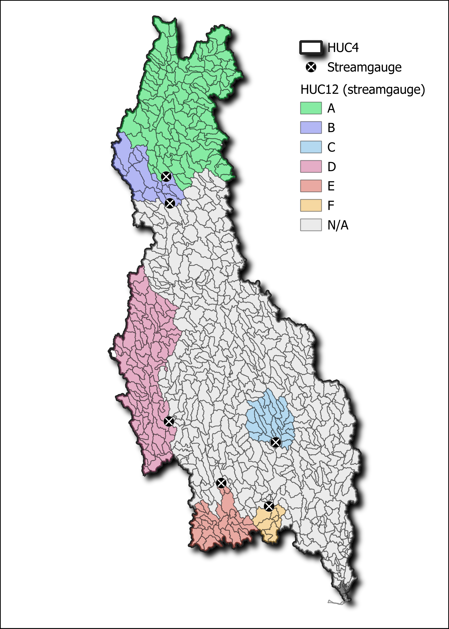
Figure 1. Example formulation regionalization for a HUC4.#
- Calculate summary score for every gage within the VPU that has calibration stats (Figure 2).
Metrics to use in composite summary score are specified in
config_formreg.yamlAlong with the metric, min and max values may be specified. If none are specified, min and max values are derived from the data. If bounds are specified, values outside the bounds will be clipped to the bounds.
Whether to use absolute values for a given metric can be specified in
config_formreg.yamlDirection of “better” metric values must be specified in
config_formreg.yamlMetric weights must be provided in
config_formreg.yamland sum to 1The summary score for each formulation at each gage is calculated by multiplying each normalized metric by the specified weight and summing them.
- Select best formulation at each gage (Figure 2).
A set of equivalent best formulations are first identified with a tolerance value (specified in
config_formreg.yaml).Final best formulation is then selected from the equivalent set, based on whether computational cost is considered.
3. Optimal formulations are then assigned to all NextGen divides upstream of a given gage (Figure 2). Note in Figure 2, NextGen divides are labeled as “HUC12”
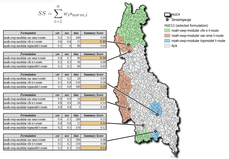
Figure 2. Calculating summary scores and selecting the best formulation.#
Divides are aggregated by spatial unit specified in spatial_unit.huc_level in config_formreg.yaml (Figure 3).
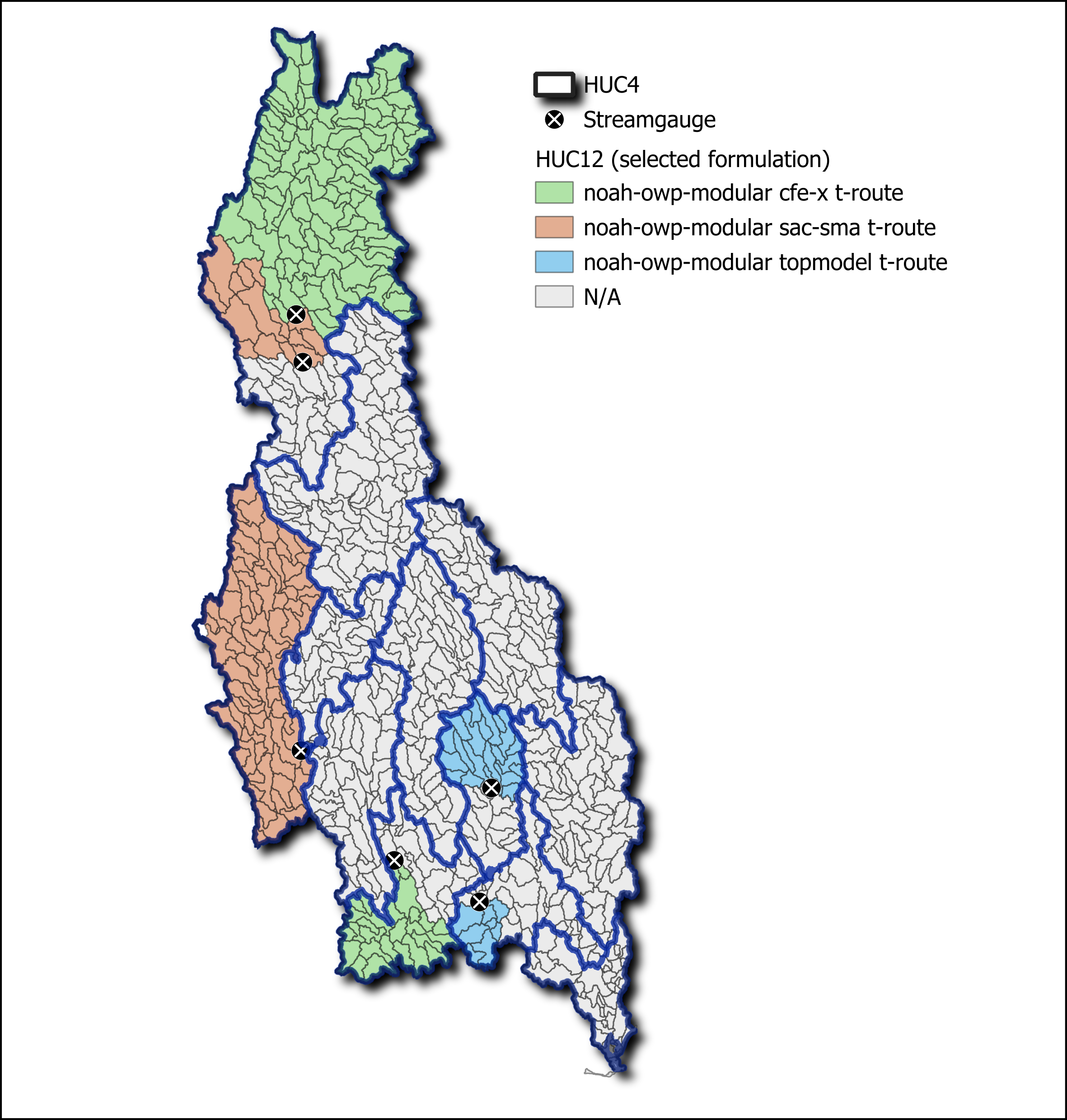
Figure 3. Spatial units for aggregation (HUC8 here).#
- An optimal formulation is then selected for each spatial unit (Figure 4).
If
spatial_unit.best_formulation.methodis “total_score”, summary scores are aggregated by formulation across all catchments in the spatial unit and the formulation with the highest value is selected.If
spatial_unit.best_formulation.methodis “average_score”, summary scores are averaged by formulation across all catchments in the spatial unit and the formulation with the highest value is selected.
If there are not enough calibrated basins in a given spatial unit (i.e., fewer than spatial_unit.nmin_calib_basin),
then the best formulation is selected from the next higher spatial unit (e.g., HUC6 instead of HUC8). This process
continues until a best formulation is selected or the highest spatial unit is reached.
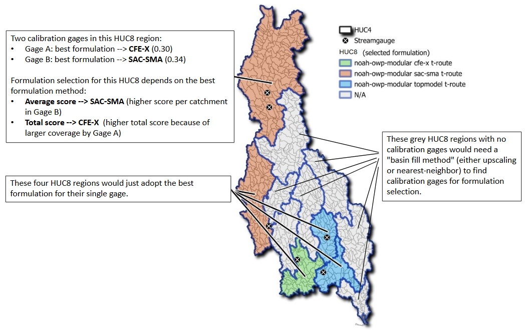
Figure 4. Aggregation to the spatial unit.#
- Assign formulations to calibrated basins (Figure 5).
If
general.approach_calib_basinsis “summary_score”, then best formulation for all calibrated divides will be reset to the formulation with the highest summary score for each gage.If
general.approach_calib_basinsis “regionalization”, then the best formulation selected for their spatial unit is retained as the best formulation for calibrated divides.
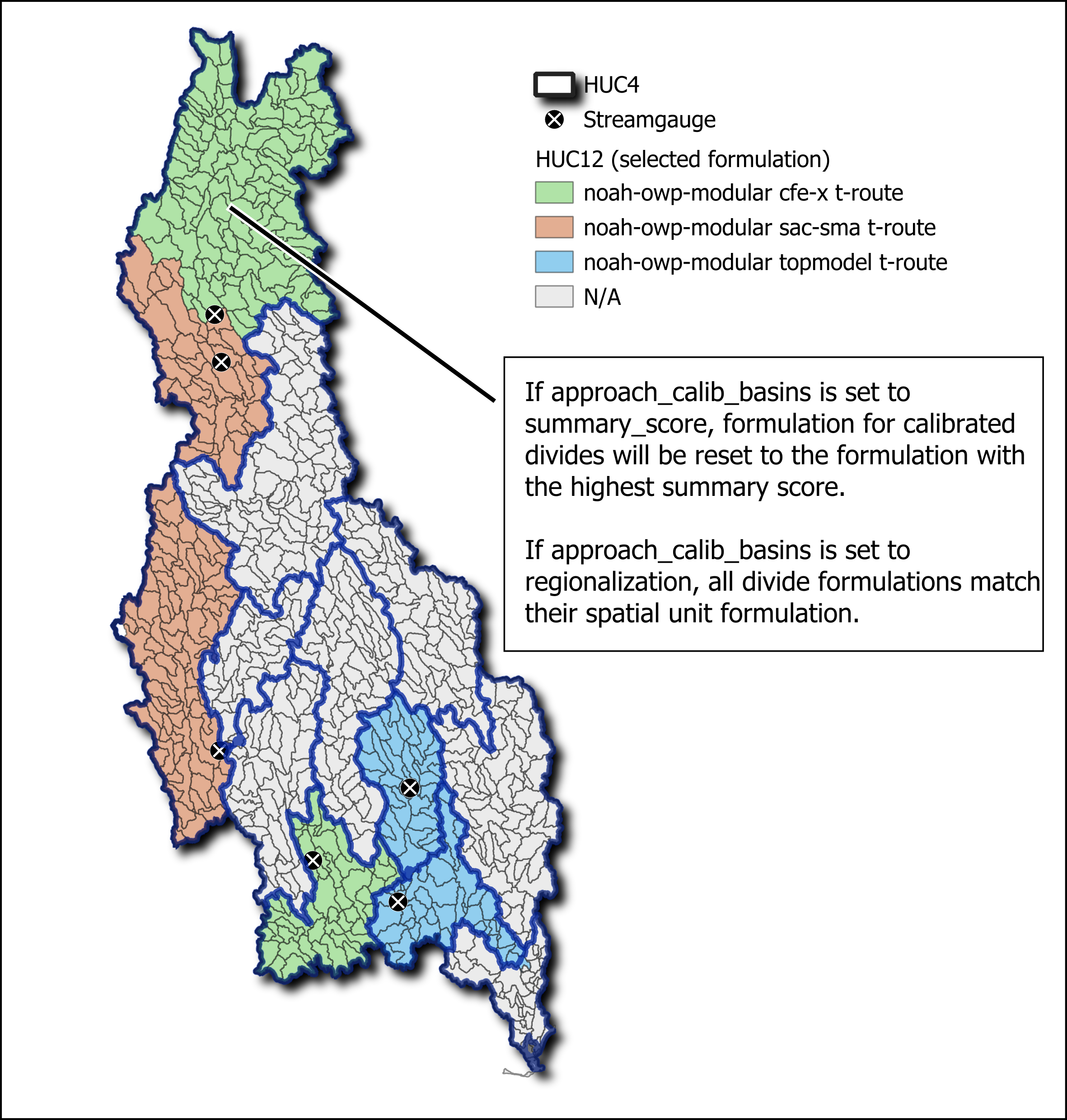
Figure 5. Optional re-designation of formulations at streamgauges.#